Ben Macdui is located in Cairngorms National Park in Scotland. It is the 2nd highest peak in all of the United Kingdom (Ben Nevis is the highest). There are a few different trails to reach the summit, and this blog will show you in depth details of one of the most common loop routes.

Length: 11 mile loop
Time to complete: allow for 6+ hours
Parking: At the upper car park of the Cairngorm Mountain Ski Centre. Cost is by donation of £2 and 24 hour parking/overnight is allowed. click here for parking location on google maps
Terrain: varied. mainly a very easy trail to follow (only in summer, in winter it’s entirely covered in snow) with a few sections of walking/scrambling over large boulders. A couple sections are steep and a ridgeline has a steep dropoff.
Step by Step Hike Information:
- There are a couple different paths that you can take from the Ski Centre parking lot, but because it is mainly an area for skiing, there are almost zero hiking trail signs. In this blog, I am going to explain the hiking loop pictured by the red line below (I used the All Trails app for it.. highly recommend that app!) To begin: If you are facing the Ski Centre from the parking lot, this loop starts on the RIGHT. You will go down and over a small set of steps and then around the bend to begin. You may see other people going to the left up the steep hill, this is the way you will return down back to the lot at the end. Trust me, it’s better that way.

**Note: The trail will not have any official sign posts on where to go, but it is very easy to follow. However, there will be 3 forks in the trail on the way to the summit. Keep RIGHT at all 3 forks. You can see them on the map above as little black dotted lines. If you go left at the first 2, you’ll end up down under the ridgelines on the little lake instead of going up. If you go left at the 3rd one, you’ll go up onto the ridgeline for a shorter loop instead of up to Ben Macdui.**
2. So after you go right at the start.. you will pass over a couple little streams/waterfalls and then uphill steadily for about the first 2 miles of the hike. Although going uphill for awhile in the beginning, it is not strenuously steep so it is the easiest route to head to the summit.

the beginning of the trail 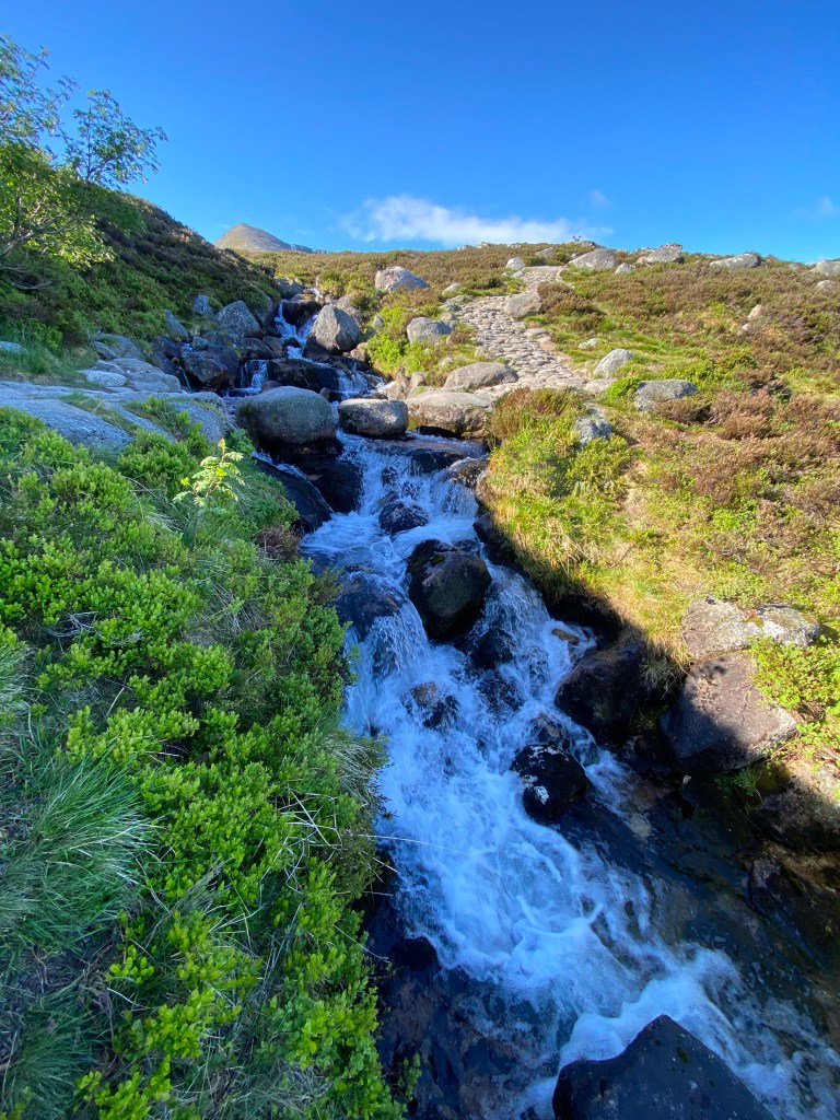
small waterfall crossing near beginning of the trail
3. Once you reach the top of the initial gradual but long ascent, you will be at the 3rd fork in the trail (and stay right at it.. left will clearly bring you up a ridgeline). Going right you will be on much flatter ground through a plain that is easy to walk through. These next 1.5 miles or so are relatively flat and reveal stunning views of the surrounding mountain peaks in the Cairngorms.

reaching top of first ascent, view to your left 
views to your right from flat plain portion 
views ahead of you from flat plain portion
4. Once you go through the plain and then curve around a large bend toward the left, Ben Macdui will finally come into view. It doesn’t look as impressive as other peaks from a distance.. it is quite rounded without snow (first picture below), but it is still the highest! — Once you descend down slightly, the trail will now merge with the other side of the loop for the last 1.5 miles up to the summit. This last 1.5 miles or so up the trail becomes less clear and turns into more of a field/hill of large scattered boulders. However, there are so many large cairns stacked up along the way to steer you in the right direction that it is very hard to get lost in summertime.

first view of ben macdui from trail 
one of many cairn stacks to keep you on route through boulder section 
approaching the boulder-filled summit
5. The summit of Ben Macdui is very rocky and relatively flat on the top. There is a trig point that marks the actual highest point as well as a couple of wind shelters people have made over the years out of boulders. It has stunning views 360 degrees.

standing on the trig point on Ben Macdui’s summit 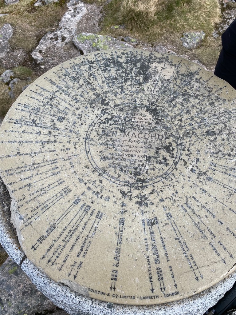
Ben Macdui summit 
on Ben Macdui’s summit
6. Begin your return to the parking lot by retracing your footsteps back down through the boulders for about 1.5 miles. When you reach the point where the trail splits back into a loop, go right to stay on the loop path.
7. The next portion of the trail is relatively flat with new views to your right, but the the trail can be partly covered in snow throughout the entire year. I hiked it on June 17 and the trail was still covered in snow in multiple places so be careful and prepared for that. This part of the trail ends when you reach the ridgeline.
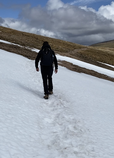
snow covering trail in June 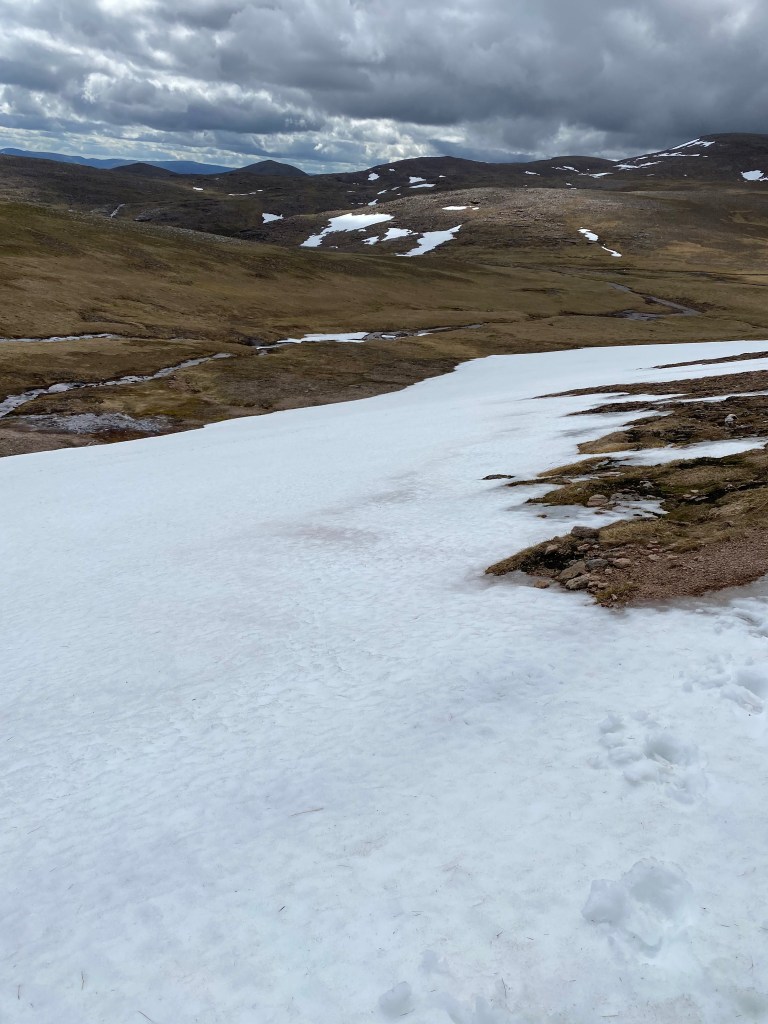
snow covering trail in June 
snow covering trail in June
8. Take in the views from on top of the ridge and then head RIGHT & UP along the ridgeline toward the summit of Cairn Gorm. (trails also go left and right/down from this point). Going right & up, you will first reach a small summit (called ‘Stob Coire an t-Sneachda’). You will then descend again slightly before your final ascent of the hike on the right up to Cairn Gorm. The trail up to Cairn Gorm is very steep but not too long.. you can do it! There is a large cairn at this summit and it will be your final view point before heading back to the parking lot.

ridgeline before Stob Coire an T-Sneachda 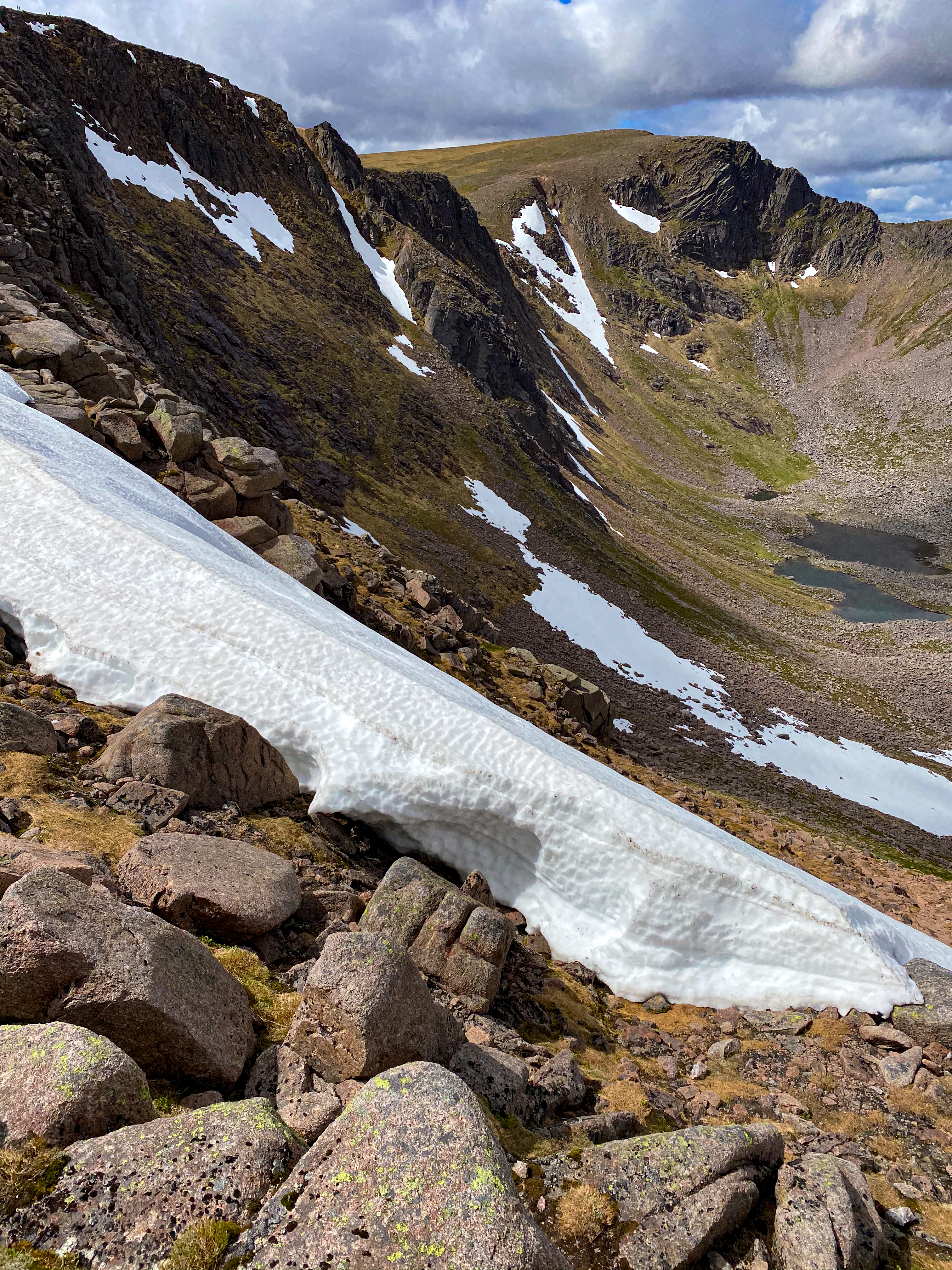
ridgeline after Stob Coire an T-Sneachda 
looking back at trail + ridgeline, taken just before Cairn Gorm ascent
9. From the summit of Cairn Gorm head down along the wide and clear ski centre path. You will soon reach the top station of the ski lift. Go around the other side of the ski lift station and follow the clear path downward all the way back to the parking lot. It is relatively steep and can be hard on the knees, but it is better to go down this part than up. (hence why I recommend going this direction for the loop!)
Hope this blog helps you successfully reach the 2nd highest point in UK! Follow me on Instagram and tag me if you make it up to Ben Macdui! As always, happy hiking!! 🙂


1 reply »